Climate Observation and Prediction
Side by side, earth system and computational scientists leverage cutting-edge earth system science and scientific tools, including artificial intelligence, to create predictive climate models with ever-increasing resolution, precision, and accuracy.
The buildup of heat trapping greenhouse gases is contributing to a range of climatic changes, from droughts and derived wildfires in the western United States, Australia, and Brazil, to floods in eastern Europe, India, and across the United States, to more frequent and severe storms across the globe. Based on the local geography, land use, and other factors, these changes will impact communities and ecosystems differently, creating a need to predict these changes at local scale — years or decades in advance — as precisely as possible.
Argonne is a leader in next-generation climate science and modeling, making leading contributions in atmospheric measurement and analysis, earth science simulations, and soil and biogeochemical science and integrating these areas to develop a predictive understanding of the role of heterogeneity in water, energy, and carbon exchanges in earth systems. The laboratory’s efforts to advance earth science simulation leverage the high-performance computing of the Argonne Leadership Computing Facility to develop robust predictive capabilities. Argonne researchers develop models and use them with field observations to understand the influence of aerosols and aerosol life cycle on low-level clouds and the earth’s radiation budget.
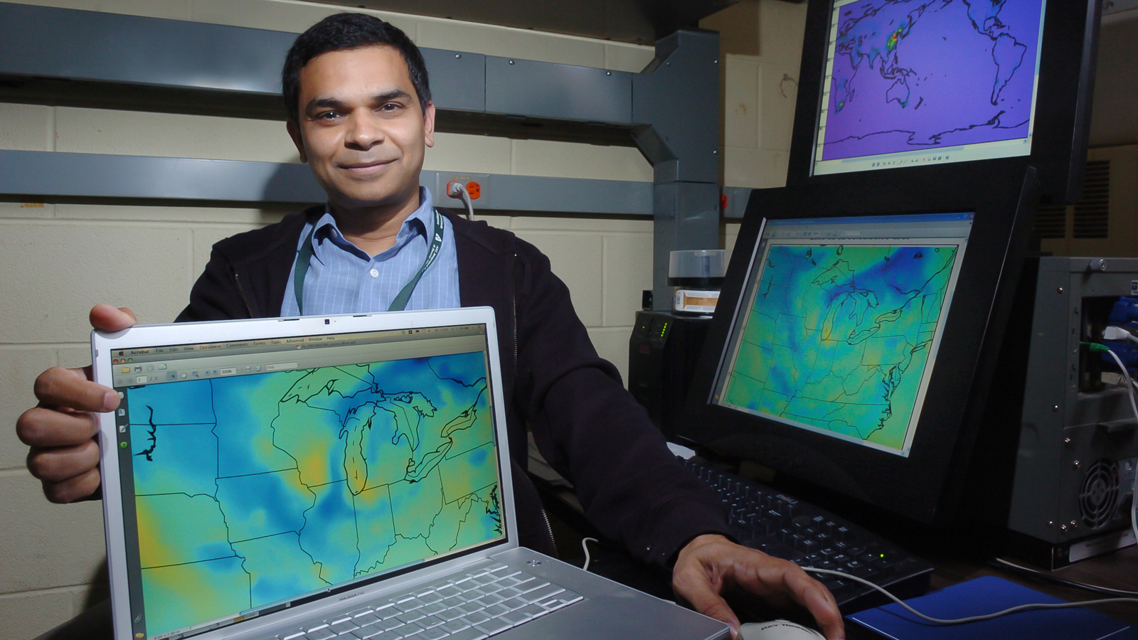
Argonne is an international leader in downscaling earth system models to project possible future local climate conditions. The lab’s 12-km-resolution climate projections for North America support quantitative analysis of risks from future extreme weather. Researchers are now making North American Continental scale simulations at the convection resolving scale of 4-km resolution.
Climate science researchers collaborate with laboratory experts in decision and information science who develop actions that governments, businesses, and other entities can take to adapt to identified risks, guard against them, or recover more rapidly from their impacts. This collaborative effort led to the establishment of the Center for Climate Resilience and Decision Science in 2021.
Learn more about our Capabilities, Facilities, and People.
CAPABILITIES
Climate Science
Weather is the state of a region’s atmosphere at a given time; it encompasses variations (e.g., in temperature, moisture, wind speed and direction, and barometric pressure) over short time periods (hours or weeks). Climate is typical weather conditions over longer periods: how frequently will specific states of the atmosphere, ocean, and land occur?
Climate science examines these relatively long-term patterns, using data from environmental sensors and numerical models of the climate to predict temperature and precipitation, circulation patterns, and ocean and biosphere conditions at the global and more local scales.
Argonne leverages its solid Earth System Science program funded by the U.S. Department of Energy (DOE) to provide the most advanced and up-to-date science to benefit collaborations with private and public entities. Collaborations with world-renowned academic institutions extend the impact of its climate science programs.
For example, Argonne operates one of the three DOE Atmospheric Radiation Measurement (ARM) user facilities (Southern Great Plains Facility) and participates in a number of observational studies around the world that study the broad range of climate conditions. These facilities advance our understanding of cloud, aerosol, precipitation, and radiative processes and provide the data to better represent these phenomena in global-scale models.
Argonne also conducts high-resolution (12 km and 4 km) climate forecast modeling using the Weather Research and Forecasting (WRF) model — a community model based at NCAR — to develop climate projections at spatial scale that are not currently feasible with global climate models (GCMs).
Climate Modeling
Earth supports a breathtaking range of geographies, ecosystems, and environments, each with an equally impressive array of constantly shifting weather patterns and events. Predicting these patterns — and extending those predictions to project longer-term climate patterns — can be extremely challenging.
Argonne uses high-performance computing tools to develop advanced, physics-based models of the Earth’s climate and applies artificial intelligence to analyze large datasets and create visualizations of the results. We leverage the expertise, resources, and facilities from across the Laboratory, using advanced geospatial capabilities to geo-reference models that can be used to support science-based decision making.
The simulations Argonne develops can capture the most detailed dynamics of climate-generating behavior — from the transport of heat through ocean eddies to the formation of storms in the atmosphere.
Argonne is one of seven DOE national laboratories working to advance a high-performance Earth system model designed to work on exascale computers.
Argonne also conducts high-resolution (4 km) climate forecast modeling using the Weather Research and Forecasting (WRF) model to improve accuracy in climate projections, especially in areas of complex geographical terrains.
Environmental Science and Modeling
Extreme storm surge is devastating coastal communities, and more severe wildfire seasons in the western United States are destroying communities and infrastructure, resulting in substantial economic losses, social stresses, environmental destruction, and loss of life. Ongoing sea level rise, storm surge from increased hurricane activity, and greater inland rainfall lead to uncertainty in forecasting and projecting both coastal and inland flooding.
Argonne’s hydrologists and environmental modeling experts focus on modeling local intense precipitation, stream and river flooding, dam failure, and coastal flooding. They are pioneering an approach that could facilitate dynamic high-resolution coastal flooding projections using inputs from atmosphere and ocean circulation models.
Argonne is also developing an innovative scientific approach to assessing future wildfire activity under changing climate conditions, calculating the most commonly used fire index using high-resolution (4-km), high-quality observation data for the last 40 years and projections for the future using dynamically downscaled climate model results. Their dataset demonstrates geographical and seasonal variations in the estimated wildfire danger and risk potential based on the changing conditions over the United States.
Atmospheric Radiation Measurement Facility
Sponsored by DOE’s Office of Science, the mission of the Atmospheric Radiation Measurement (ARM) User Facility is to advance our understanding of cloud, aerosol, precipitation, and radiation processes and provide data to better represent these phenomena in global-scale models. Advances in our scientific understanding of atmospheric phenomena lead to better climate models, which can help to clarify, or reduce uncertainties in, our understanding of future climate. ARM tools that allow users to visualize the atmosphere and variabilities in climate and geography in turn enable our scientists to build next-generation climate models that accelerate our understanding of climate dynamics and enable better understanding of how those will lead to changing impacts on infrastructure and communities in the future.
Argonne Visualization Lab
The Argonne Visualization Laboratory is home to the ActiveMural, a 27-foot by 8-foot interactive tiled display wall, where scientists can collaborate and share scientific data visualizations. Because climate models generate purely numerical outputs, this space provides an opportunity for Argonne’s climate and environmental scientists to visualize — at large scales that take advantage of our high-resolution modeling — how future climate trends and extreme events will unfold at regional scales or zoomed in to hyper-local scales. The large scale of the Visualization Lab’s ActiveMural also enables side-by-side comparisons of dozens of scenarios at one time, providing a way to visually explore subtle difference in modelling outcomes and uncertainties.
Argonne Leadership Computing Facility
The Argonne Leadership Computing Facility (ALCF), a DOE Office of Science User Facility, enables breakthroughs in science and engineering by providing supercomputing resources and expertise to the research community. The higher-resolution simulations, continental-scale study areas, and decades-long periods for future simulations that climate models need to deliver more detailed, location-specific, and actionable projections require more computations and therefore more computing power. ALCF’s supercomputing capabilities enable Argonne’s climate and environmental scientists to run these simulations in a matter of days, weeks, or months, instead of the years — or even decades — that would be required using conventional computers.


